 Altădată
Existing church · 1724
Stavropoleos Monastery
Stavropoleos Church was built in 1724, during the reign of Nicolae Mavrocordat, by the Epirote archimandrite Ioanichie Stratonikeas, within the precinct of the inn he had built in 1704; the small monastery was supported by the inn's income. The name comes from the metropolitan see of Stavropolis, which Ioanichie received in 1726, and means “City of the Cross” in Greek. The inn and its outbuildings were demolished toward the end of the 19th century, and the adjoining building, with a library and an icon collection, was designed by Ion Mincu. The church, a landmark of the Brâncovenesc style, became a convent of nuns again in 2008.
See the place on the old maps ›Text source: ro.wikipedia.org · summary based on the source
Old photographs
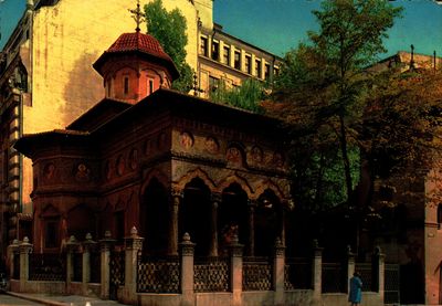
Biserica Stavropoleos
1700 · Institutul Național al Patrimoniului, colecția Andrei Ștomff · CC BY-SA 4.0
Butoaie si poarta han stavropoleos
1856 · Ludwig Angerer · Public domain
L'Eglise Stavropoleus
1902 · Alexandru Antoniu · Public domain
Stavropoleos Church
1930 · Nicolae Ionescu · Public domain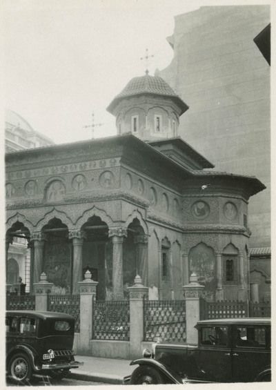
Mănăstirea Stavropoleos
1932 · Carl Uhlig · Leibniz-Institut für Länderkunde · CC BY-NC-SA 4.0
Kirche Stravropoleos, Portal
1935 · CC BY 4.0


On the old maps
The place appears on 45 maps and images, from 1790 to today:
- 1790 · Specht Plan
- 1791 · Ernst Plan
- 1846 · Borroczyn Plan
- 1852 · Borroczyn Plan
- 1864 · Szathmari Plan
- 1871 · Pappasoglu Plan
- 1883 · Cerkez Plan
- 1893 · Orăscu Plan
- 1896 · J. Don Plan
- 1900 · Plan of Bucharest 1900
- 1911 · Army Geographic Institute Plan
- 1914 · Socec Plan
- 1921 · Mihai Pantea Plan
- 1926 · Union Plan
- 1927 · Aerial photo 1927
- 1927 · Socec Plan
- 1928 · Industrial Plan
- 1931 · STB Plan
- 1931 · Unirea Plan
- 1934 · Wahing Plan
- 1938 · Aerial photo 1938
- 1938 · Teodorescu Plan
- 1939 · Simboteanu and Moldoveanu Plan
- ~1940 · Artillery Firing Plans
- 1943 · Aerial photo 1943
- 1962 · Cadastral Plan (center)
- 1966 · Satellite image 1966
- 1968 · Map of Bucharest 1968
- 1969 · Map of Bucharest 1969
- 1972 · Satellite image 1972
- 1974 · Cadastral Plan (center)
- 1976 · Satellite image 1976
- 1977 · Satellite image 1977
- 1978 · Satellite image 1978
- 1979 · Satellite image 1979
- 1980 · Satellite image 1980
- 1982 · Satellite image 1982
- 1982 · ITB Plan
- 1983 · Satellite image 1983
- 1984 · Satellite image 1984
- ~1985 · Soviet Topographic Map
- 1990 · Cadastral Plan
- 2001 · AGC Polonia Plan
- 2017 · Orthophoto 2017
- today · Current satellite
Nearby
- Dacia-România Insurance Company Palace · 40 m
- Church of the Greeks – Ghiorma Banul (lost) · 40 m
- National Bank of Romania Palace · 80 m
- Șerban Vodă Inn Church (lost) · 90 m
- St. Demetrius-Poștă Church · 110 m
- Post Office Palace · 110 m