 Altădată
Historic building · 1882–1889
Dacia-România Insurance Company Palace
The palace at the meeting point of Lipscani, Smârdan and Stavropoleos streets was built, according to some sources, between 1882 and 1889 for the Dacia-România insurance company. The monumental façades are adorned with allegorical sculptures of Justice, Commerce, Industry and Agriculture. The careful restoration of 1984–1985, led by the architects Constantin Rulea and Octav Dimitriu, kept almost intact this building, which is representative of German-influenced Bucharest architecture. In 2013 the municipality decided to take over the building from BCR in order to set up the Bucharest Art Gallery (Pinacoteca Bucureștiului) here.
See the place on the old maps ›Text source: ro.wikipedia.org · summary based on the source
Old photographs
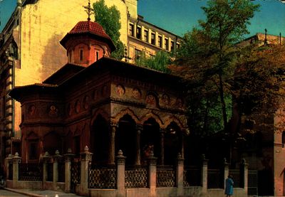
Biserica Stavropoleos
1700 · Institutul Național al Patrimoniului, colecția Andrei Ștomff · CC BY-SA 4.0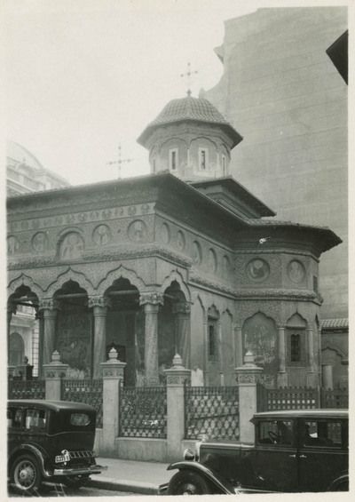
Mănăstirea Stavropoleos
1932 · Carl Uhlig · Leibniz-Institut für Länderkunde · CC BY-NC-SA 4.0
On the old maps
The place appears on 45 maps and images, from 1790 to today:
- 1790 · Specht Plan
- 1791 · Ernst Plan
- 1846 · Borroczyn Plan
- 1852 · Borroczyn Plan
- 1864 · Szathmari Plan
- 1871 · Pappasoglu Plan
- 1883 · Cerkez Plan
- 1893 · Orăscu Plan
- 1896 · J. Don Plan
- 1900 · Plan of Bucharest 1900
- 1911 · Army Geographic Institute Plan
- 1914 · Socec Plan
- 1921 · Mihai Pantea Plan
- 1926 · Union Plan
- 1927 · Aerial photo 1927
- 1927 · Socec Plan
- 1928 · Industrial Plan
- 1931 · STB Plan
- 1931 · Unirea Plan
- 1934 · Wahing Plan
- 1938 · Aerial photo 1938
- 1938 · Teodorescu Plan
- 1939 · Simboteanu and Moldoveanu Plan
- ~1940 · Artillery Firing Plans
- 1943 · Aerial photo 1943
- 1962 · Cadastral Plan (center)
- 1966 · Satellite image 1966
- 1968 · Map of Bucharest 1968
- 1969 · Map of Bucharest 1969
- 1972 · Satellite image 1972
- 1974 · Cadastral Plan (center)
- 1976 · Satellite image 1976
- 1977 · Satellite image 1977
- 1978 · Satellite image 1978
- 1979 · Satellite image 1979
- 1980 · Satellite image 1980
- 1982 · Satellite image 1982
- 1982 · ITB Plan
- 1983 · Satellite image 1983
- 1984 · Satellite image 1984
- ~1985 · Soviet Topographic Map
- 1990 · Cadastral Plan
- 2001 · AGC Polonia Plan
- 2017 · Orthophoto 2017
- today · Current satellite
Nearby
- Church of the Greeks – Ghiorma Banul (lost) · 10 m
- Stavropoleos Monastery · 40 m
- National Bank of Romania Palace · 40 m
- Șerban Vodă Inn Church (lost) · 60 m
- Zlătari Church · 120 m
- St. Demetrius-Poștă Church · 140 m