 Altădată
Lost church · 1710 (demolată c. 1959)
Brezoianu Church (lost)
Brezoianu Church bore the name of the boyar Pătrașcu Brezoianu, to whom Constantin Brâncoveanu granted a plot of land in this area in 1703, and after whom Brezoianu Street is also named. The masonry church was built in 1710, in place of a wooden one. It came through the 1940 earthquake and the 1944 bombings, probably already in poor condition, and disappeared around 1959, with the redevelopment of the area behind the Royal Palace, where Sala Palatului was built at that time.
See the place on the old maps ›Text source: rri.ro · summary based on the source
Old photographs
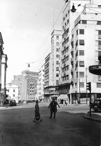
Strada Ion Câmpineanu, a Strada Academiei kereszteződésétől a Calea Victoriei felé nézve
1958 · FORTEPAN / Vojnich Pál · CC BY-SA 3.0
On the old maps
The place appears on 45 maps and images, from 1790 to today:
- 1790 · Specht Plan
- 1791 · Ernst Plan
- 1846 · Borroczyn Plan
- 1852 · Borroczyn Plan
- 1864 · Szathmari Plan
- 1871 · Pappasoglu Plan
- 1883 · Cerkez Plan
- 1893 · Orăscu Plan
- 1896 · J. Don Plan
- 1900 · Plan of Bucharest 1900
- 1911 · Army Geographic Institute Plan
- 1914 · Socec Plan
- 1921 · Mihai Pantea Plan
- 1926 · Union Plan
- 1927 · Aerial photo 1927
- 1927 · Socec Plan
- 1928 · Industrial Plan
- 1931 · STB Plan
- 1931 · Unirea Plan
- 1934 · Wahing Plan
- 1938 · Aerial photo 1938
- 1938 · Teodorescu Plan
- 1939 · Simboteanu and Moldoveanu Plan
- ~1940 · Artillery Firing Plans
- 1943 · Aerial photo 1943
- 1962 · Cadastral Plan (center)
- 1966 · Satellite image 1966
- 1968 · Map of Bucharest 1968
- 1969 · Map of Bucharest 1969
- 1972 · Satellite image 1972
- 1974 · Cadastral Plan (center)
- 1976 · Satellite image 1976
- 1977 · Satellite image 1977
- 1978 · Satellite image 1978
- 1979 · Satellite image 1979
- 1980 · Satellite image 1980
- 1982 · Satellite image 1982
- 1982 · ITB Plan
- 1983 · Satellite image 1983
- 1984 · Satellite image 1984
- ~1985 · Soviet Topographic Map
- 1990 · Cadastral Plan
- 2001 · AGC Polonia Plan
- 2017 · Orthophoto 2017
- today · Current satellite
Nearby
- St. Ionică Church (lost) · 90 m
- Avântul Țării Monument · 120 m
- Stejarul Church · 120 m
- Palace Hall · 120 m
- Kretzulescu Church · 170 m
- Reformed (Calvinist) Church · 230 m