 Altădată
Lost church · sec. al XVI-lea; demolată după 1864
St. Sava Monastery (lost)
On this site, in front of the University Palace, stood St. Sava Monastery, attested since the 16th century. From 1694 its buildings housed the Princely Academy founded by Constantin Brâncoveanu, the first institution of higher learning in Wallachia, and in 1818 Gheorghe Lazăr opened his school teaching in Romanian here. Part of the ensemble was torn down in the mid-19th century, when the University Palace was built, and the church disappeared a few years after 1864. The statue of Mihai Viteazul stands on the site of the monastery's former altar.
See the place on the old maps ›Text source: tvrinfo.ro · summary based on the source
Old photographs
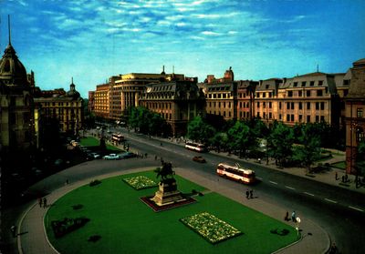
Piața Universității
1800 · Institutul Național al Patrimoniului, colecția Andrei Ștomff · CC BY-SA 4.0
Statuia lui Mihai Viteazul
1877 · Franz Duschek · Public domain
Monument of Michel le Brave
1897 · Public domain
Statue of Mihai Viteazul in University Square in Bucharest
1900 · Public domain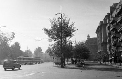
Bulevardul Nicolae Bălcescu a Strada Ion Câmpineanu torkolatától a Piața Universității felé nézve
1958 · FORTEPAN / Várkonyi Andrea · CC BY-SA 3.0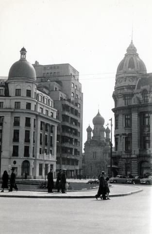
Piata Universităţii, szemben a Strada Toma Caragiu, távolabb a Strada Ioan Ghica mellett a Szent Miklós orosz
1958 · FORTEPAN / Virány László · CC BY-SA 3.0


On the old maps
The place appears on 45 maps and images, from 1790 to today:
- 1790 · Specht Plan
- 1791 · Ernst Plan
- 1846 · Borroczyn Plan
- 1852 · Borroczyn Plan
- 1864 · Szathmari Plan
- 1871 · Pappasoglu Plan
- 1883 · Cerkez Plan
- 1893 · Orăscu Plan
- 1896 · J. Don Plan
- 1900 · Plan of Bucharest 1900
- 1911 · Army Geographic Institute Plan
- 1914 · Socec Plan
- 1921 · Mihai Pantea Plan
- 1926 · Union Plan
- 1927 · Aerial photo 1927
- 1927 · Socec Plan
- 1928 · Industrial Plan
- 1931 · STB Plan
- 1931 · Unirea Plan
- 1934 · Wahing Plan
- 1938 · Aerial photo 1938
- 1938 · Teodorescu Plan
- 1939 · Simboteanu and Moldoveanu Plan
- ~1940 · Artillery Firing Plans
- 1943 · Aerial photo 1943
- 1962 · Cadastral Plan (center)
- 1966 · Satellite image 1966
- 1968 · Map of Bucharest 1968
- 1969 · Map of Bucharest 1969
- 1972 · Satellite image 1972
- 1974 · Cadastral Plan (center)
- 1976 · Satellite image 1976
- 1977 · Satellite image 1977
- 1978 · Satellite image 1978
- 1979 · Satellite image 1979
- 1980 · Satellite image 1980
- 1982 · Satellite image 1982
- 1982 · ITB Plan
- 1983 · Satellite image 1983
- 1984 · Satellite image 1984
- ~1985 · Soviet Topographic Map
- 1990 · Cadastral Plan
- 2001 · AGC Polonia Plan
- 2017 · Orthophoto 2017
- today · Current satellite
Nearby
- Statue of Ion Heliade-Rădulescu · 30 m
- University Palace · 60 m
- Statue of Spiru Haret · 70 m
- Suțu Palace · 100 m
- Ion Mincu Institute of Architecture Palace · 140 m
- Doamnei Church · 180 m